Explore Drone Tours With Scenic Landscapes, Travel Photography, and Adventure Tips
Drone tours combine aerial photography, sightseeing, travel planning, and small unmanned aircraft operations to create a different way of viewing landscapes. A drone can capture coastlines, mountains, forests, lakes, historic areas, deserts, and city environments from elevated viewpoints that are difficult to obtain from ground level.
These tours may be organized around photography, sightseeing, adventure travel, documentary projects, or personal exploration.
The development of compact camera drones has made aerial photography more accessible to travelers. Modern consumer drones can include stabilized cameras, navigation systems, obstacle-sensing technology, automated flight modes, and location information. These features allow travelers to create photographs and videos while concentrating on composition and flight awareness.
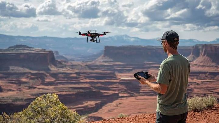
Drone tours can take several forms. A traveler may operate a drone independently during a permitted trip, participate in a guided aerial photography activity, or join an organized tour where an experienced operator handles the aircraft. The rules and responsibilities can differ considerably between these arrangements.
Travelers also need to understand that a drone is an aircraft rather than simply a camera. Flight areas, altitude limits, registration requirements, privacy considerations, weather conditions, protected locations, and airport restrictions can affect where and how it can be operated.
Common Uses of Drone Tours
Drone photography can be used for several travel purposes:
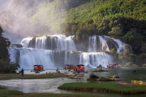
Scenic landscape photography
Coastal and beach photography
Mountain and hiking documentation
Adventure travel videos
Architectural photography
Cultural landscape documentation
Nature and environmental observation
Travel destination videos
Personal trip records
Aerial mapping for permitted activities
The appropriate use depends on local rules, the surrounding environment, and the purpose of the flight.
Planning an Aerial Travel Experience
A successful drone tour begins before the aircraft is launched. Travelers need to examine the destination, understand applicable flight restrictions, check weather conditions, prepare batteries, inspect equipment, and identify a suitable takeoff and landing area.
A basic planning process can include checking local aviation rules, reviewing restricted-airspace information, studying terrain, checking weather, confirming battery condition, and preparing backup plans. A scenic location may look suitable from the ground but still have restrictions that prevent drone operation.
Importance
Drone tours matter because aerial imagery has become an important part of modern travel photography. Elevated viewpoints can reveal patterns in landscapes, coastlines, architecture, agricultural areas, and natural formations that may not be visible from ground level.
The technology also affects photographers, tourism businesses, filmmakers, conservation groups, travelers, local communities, and aviation authorities. As drone use increases, responsible operation becomes important for protecting people, privacy, wildlife, cultural locations, and airspace.
Scenic Landscape Photography
Aerial photography changes the way landscapes can be composed. Instead of photographing only from eye level, a drone can provide overhead, diagonal, and wide-angle perspectives.
Useful composition approaches include:
Leading lines created by roads, rivers, or shorelines
Symmetry in buildings or natural formations
Contrasting colors between land and water
Repeating patterns in fields or architecture
Scale comparisons involving people or structures
Layered views of mountains and surrounding terrain
Lighting also influences aerial images. Early morning and late afternoon can produce different shadows and textures compared with bright midday conditions.
Adventure and Outdoor Travel
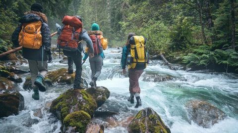
Drone tours are sometimes combined with hiking, camping, cycling, boating, climbing, or other outdoor activities. In these situations, the drone becomes another piece of equipment that needs to be carried, protected, and monitored.
Terrain can create additional challenges. Mountains, cliffs, trees, buildings, and narrow valleys may interfere with satellite signals or obstacle detection. Wind can also change rapidly around elevated terrain and coastal areas.
Travelers should avoid allowing photography goals to override basic flight safety. A visually interesting location is not necessarily an appropriate place for drone operation.
Privacy and Community Considerations
Aerial cameras can capture people, homes, private property, and activities that were not intended to be photographed. Privacy expectations vary across countries and communities.
Responsible drone photography means avoiding unnecessary filming of individuals and respecting signs, local instructions, private areas, cultural practices, and community expectations. Extra care may be appropriate around beaches, residential areas, festivals, religious sites, and crowded public spaces.
Recent Updates
From 2024 through 2026, drone technology has continued to develop around improved image stabilization, obstacle detection, automated flight functions, compact designs, battery management, and software-based flight controls. At the same time, aviation authorities in many regions have continued refining rules for recreational and commercial unmanned aircraft operations.
Smarter Flight Assistance
Modern drones increasingly use sensors and software to assist with positioning, obstacle awareness, return-to-home functions, subject tracking, and automated camera movements. These features can reduce some operational complexity, but they do not remove the need for pilot awareness.
Automated functions can behave differently depending on terrain, lighting, satellite reception, signal conditions, and surrounding objects. Pilots remain responsible for understanding the aircraft's limitations.
Improved Travel Photography
Camera systems continue to provide higher image quality, stabilized video, wider dynamic range, and more sophisticated exposure controls. Compact designs are also useful for travelers who need to carry equipment during outdoor activities.
Automated panorama, tracking, and waypoint features can help create different types of aerial imagery where permitted. Travelers should verify whether automated flight modes are allowed under local rules.
Battery and Flight Planning
Battery management remains an important part of drone travel. Cold temperatures, strong winds, repeated acceleration, and long-distance flights can affect battery performance.
Travel planning increasingly includes digital battery monitoring and flight-planning applications. These tools can display estimated flight areas, weather conditions, and airspace information, although users should verify critical regulatory information with the relevant aviation authority.
Responsible Tourism
Drone tourism is also increasingly connected with responsible travel. Wildlife areas, heritage locations, crowded attractions, and environmentally sensitive sites may have additional restrictions.
Some destinations prohibit drone flights in particular areas, while others require authorization. Responsible tourism therefore involves checking local requirements rather than assuming that general recreational rules apply everywhere.
Laws or Policies
Drone regulations vary significantly between countries and can also differ between regions within the same country. Rules may cover aircraft registration, pilot competency, operating altitude, visual line of sight, restricted airspace, protected areas, privacy, insurance, and flights near people or airports.
Aviation Requirements
Many aviation authorities distinguish between recreational and commercial or professional drone operations. Some aircraft categories may require registration, while certain operations may require additional authorization or pilot qualifications.
Common regulatory concepts include:
Maximum permitted flight altitude
Visual line-of-sight requirements
Restrictions near airports
Prohibited or controlled airspace
Rules around crowds and populated areas
Aircraft registration
Pilot competency requirements
Remote identification requirements in some jurisdictions
Restrictions around government or critical infrastructure
These requirements change between jurisdictions. Travelers should check the aviation authority responsible for the destination before operating a drone.
Protected and Cultural Locations
National parks, wildlife reserves, archaeological areas, military locations, government facilities, and heritage sites can have additional restrictions. A destination may permit visitors while separately restricting drone flights.
Cultural locations can also have rules concerning photography and filming. Religious ceremonies, sacred spaces, and community events may require additional sensitivity.
Privacy and Data Protection
Drone photography can raise privacy concerns because cameras may record individuals without their direct knowledge. Some jurisdictions have specific privacy or data-protection requirements affecting aerial photography.
Travelers should avoid recording private spaces unnecessarily and should follow local requirements concerning the collection, storage, and publication of identifiable imagery.
Tools and Resources
Drone tour planning can involve several digital and physical resources. Official aviation authority websites are important for checking current rules, registration requirements, airspace restrictions, and operating limitations.
Weather applications can provide information about wind, precipitation, temperature, visibility, and other conditions. Mapping applications can help travelers understand terrain, access routes, takeoff locations, and surrounding structures.
Useful resources include:
Official aviation authority portals
Airspace maps
Weather applications
Digital mapping platforms
Drone flight-planning applications
Camera exposure guides
Battery management tools
Photography composition guides
Travel itinerary planners
Equipment inspection checklists
Memory-card management tools
Digital image organization platforms
A basic comparison of common drone-tour considerations is shown below:
| Activity | Main Consideration | Important Planning Area |
|---|---|---|
| Scenic Photography | Composition and lighting | Landscape and weather |
| Coastal Flying | Wind and people | Airspace and shoreline |
| Mountain Flying | Terrain and wind | Elevation and signal |
| City Photography | Buildings and crowds | Urban restrictions |
| Wildlife Imaging | Animal disturbance | Protected-area rules |
| Adventure Filming | Movement and equipment | Weather and terrain |
| Cultural Photography | Privacy and customs | Local permissions |
A pre-flight checklist can also help organize preparation. It may include aircraft condition, propellers, battery level, controller connection, storage capacity, weather, airspace restrictions, takeoff area, landing area, and emergency procedures.
FAQs
What are drone tours?
Drone tours are travel or photography experiences involving aerial views captured with unmanned aircraft. They can focus on scenic landscapes, adventure activities, cultural locations, architecture, or personal travel documentation.
Are drone tours allowed everywhere?
No. Drone operation can be restricted near airports, military areas, government facilities, protected environments, crowded locations, and other controlled areas. Rules vary by destination, so local aviation requirements need to be checked before flight.
How can drones improve travel photography?
Drones provide elevated perspectives that can reveal patterns, scale, terrain, coastlines, architecture, and natural formations. Stabilized cameras and automated flight features can also support aerial photography and video production.
What should travelers check before a drone tour?
Travelers should check local aviation rules, registration requirements, restricted airspace, weather, wind, battery condition, takeoff and landing areas, privacy considerations, and restrictions around protected or cultural locations.
What are important drone safety considerations for adventure travel?
Terrain, weather, battery capacity, signal conditions, people, wildlife, and obstacles should all be considered. Pilots should maintain appropriate awareness of the aircraft and follow the operating limits established for the destination.
Conclusion
Drone tours combine aerial technology with scenic exploration, travel photography, and outdoor adventure. Modern drones provide stabilized cameras, navigation assistance, sensing technology, and automated functions that support a variety of permitted photography activities. However, responsible operation requires attention to aviation rules, weather, terrain, privacy, wildlife, cultural locations, and public safety. The applicable requirements vary by destination, making local regulatory information an important part of drone travel planning.