Mine Tailings Monitoring Technology Guide: Systems, Sensors and Risk Detection
Mine tailings monitoring technology refers to the systems, instruments, and procedures used to observe the condition of mine waste storage facilities and identify changes that could indicate a safety or environmental concern. Mine tailings are the finely ground materials left after valuable minerals have been separated from mined rock. They may contain water, residual minerals, processing chemicals, and other substances, depending on the ore and the extraction process.
Context
Mine tailings monitoring technology refers to the systems, instruments, and procedures used to observe the condition of mine waste storage facilities and identify changes that could indicate a safety or environmental concern. Mine tailings are the finely ground materials left after valuable minerals have been separated from mined rock. They may contain water, residual minerals, processing chemicals, and other substances, depending on the ore and the extraction process.
Tailings are commonly stored in engineered facilities called tailings storage facilities (TSFs). These facilities may use embankments, natural depressions, lined containment areas, or combinations of construction methods. Their design depends on the material being stored, local geology, climate, water management requirements, and the characteristics of the mining operation.
Mine tailings monitoring technology developed from traditional inspections, surveying, and manual measurements. Modern systems can combine ground-based instruments, satellite observations, automated sensors, and data analysis tools to provide a more detailed picture of changing conditions. These technologies support risk detection, environmental management, and the ongoing assessment of facility performance.
Main Types of Tailings Storage Facilities
Tailings storage facilities vary according to their design and operating conditions. Common approaches include:
Upstream embankments: Raised structures built progressively over deposited tailings. Their stability can depend strongly on the properties and condition of the deposited material.
Downstream embankments: Structures expanded outward from the original embankment, with construction progressing toward the downstream side.
Centerline embankments: Structures raised around a relatively consistent central alignment.
Filtered tailings facilities: Systems in which much of the water is removed before the tailings are placed, generally producing a drier material.
Water-retaining or lined facilities: Designs that incorporate containment and water-control features appropriate to site conditions.
Each design has different monitoring requirements. Instruments must be selected according to the potential failure mechanisms, the facility's geometry, groundwater conditions, and the surrounding environment.
Importance
Mine tailings monitoring technology matters because a failure at a tailings storage facility can release large quantities of water and mine waste. Potential consequences include injuries or fatalities, damage to buildings and infrastructure, contamination of rivers and soil, disruption to communities, and long-term environmental effects.
Monitoring is relevant to mining operators, engineers, regulators, emergency planners, nearby residents, and environmental specialists. It helps identify changes in embankment movement, groundwater pressure, seepage, water levels, and other conditions that may require investigation. However, monitoring cannot eliminate every hazard, and the meaning of a measurement depends on site conditions and professional interpretation.
Key Risks Detected by Monitoring Systems
Several types of change can be important when assessing tailings facility performance:
Ground movement: Shifts, settlement, or deformation affecting an embankment or nearby land.
Pore water pressure: Pressure within water-filled spaces in soil or tailings, which can influence material strength and stability.
Seepage changes: Unexpected increases or changes in water emerging from an embankment or its foundation.
Water level changes: Variations in the pond, stored water, or groundwater that affect the facility's water balance.
Cracks and surface changes: Visible features that may require inspection to determine whether they indicate movement or another problem.
Erosion and drainage problems: Damage or blockages that can affect how water moves through or around the facility.
A single unusual reading does not automatically mean a facility is failing. Engineers generally assess measurements alongside historical records, site inspections, weather conditions, construction information, and other evidence.
Comparing Mine Tailings Monitoring Technologies
Different instruments measure different aspects of facility behavior. A monitoring plan may combine several methods rather than depend on a single technology.
| Technology | What it measures or observes | Common purpose |
|---|---|---|
| Piezometers | Pore water pressure or water level, depending on type | Assessing groundwater conditions |
| Inclinometers | Subsurface lateral movement | Identifying deformation at depth |
| GNSS surveying | Positions of selected points | Tracking surface displacement |
| Robotic total stations | Survey targets and their positions | Repeated measurements of surface movement |
| Satellite radar interferometry (InSAR) | Surface displacement over time | Observing broad areas for movement |
| Drones and aerial surveys | Surface features and terrain | Mapping erosion, cracks, and changing geometry |
| Water-level sensors | Water elevation in selected locations | Supporting pond and water-balance management |
| Seepage monitoring instruments | Water flow or related conditions | Tracking drainage and seepage changes |
Instrument performance depends on installation, maintenance, environmental conditions, measurement frequency, and data quality. Some methods provide frequent readings at specific locations, while others cover larger areas at intervals determined by the observation system.
Recent Updates
From 2024 through 2026, mine tailings monitoring has continued to move toward more integrated observation, automated data collection, remote sensing, and risk-based interpretation. These developments reflect the need to understand both local changes and broader patterns across large or difficult-to-access facilities. Adoption varies according to the mine, regulatory environment, available infrastructure, and technical requirements.
Remote Sensing and Satellite Monitoring
Satellite radar interferometry can detect small changes in the position of ground surfaces over repeated observations. It can help identify areas that may require closer examination, including changes outside the locations covered by installed ground instruments. However, vegetation, surface conditions, atmospheric effects, viewing geometry, and the timing of satellite passes can affect results.
Drone surveys and photogrammetry can produce detailed surface maps and digital terrain models. Repeated surveys may help engineers compare embankment geometry, identify erosion, and examine changes in drainage channels. These methods complement rather than replace direct measurements and physical inspections.
Automated Sensors and Data Analysis
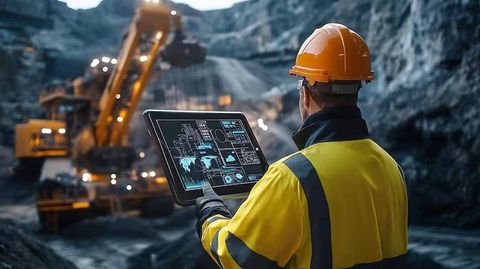
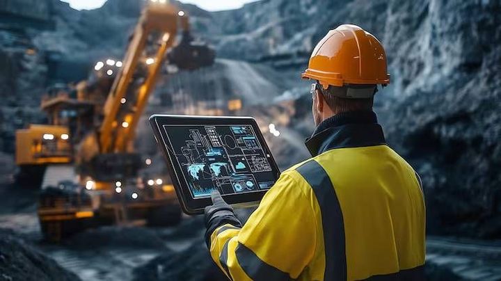
Automated instruments can transmit readings to monitoring platforms at regular intervals or when specified conditions occur. Software can display trends, compare current readings with established thresholds, and alert designated personnel when measurements require review.
Data analysis tools, including machine-learning methods, are also being explored for identifying unusual patterns across large datasets. Their reliability depends on the quality and quantity of available data, suitable validation, and understanding of site-specific conditions. An algorithmic alert should be treated as information for investigation, not as proof of an impending failure.
Integrated Monitoring and Governance
Current practice increasingly emphasizes combining engineering assessments, monitoring data, inspections, and emergency planning. The Global Industry Standard on Tailings Management (GISTM) provides a framework addressing the safety of tailings facilities throughout their life cycle, including governance, risk management, public disclosure, and emergency preparedness.
Technology is only one part of this framework. Clear responsibilities, qualified personnel, documented procedures, reliable communications, and regular review are also important to effective tailings risk management.
Laws or Policies
Mine tailings monitoring requirements vary by country, state or province, mine type, permit conditions, and facility design. Regulations may address dam safety, environmental protection, water quality, mine waste management, inspections, incident reporting, and emergency planning. The applicable requirements should be assessed for the specific site and jurisdiction.
Regulatory Framework in India
In India, mining and tailings management may involve requirements under the Mines and Minerals (Development and Regulation) Act, 1957, applicable mining rules, environmental legislation, and the conditions attached to environmental clearances and other permissions. The Environment (Protection) Act, 1986, and the Water (Prevention and Control of Pollution) Act, 1974, may also be relevant to environmental protection and water pollution control.
Depending on the project, authorities such as the Ministry of Environment, Forest and Climate Change, the Central Pollution Control Board, and the relevant State Pollution Control Board may have roles in approvals, oversight, or compliance. Requirements differ according to the activity and the legal instrument that applies. Not every tailings facility is subject to an identical monitoring regime.
International Standards and Industry Guidance
The Global Industry Standard on Tailings Management provides an internationally used framework for managing tailings-related risks. It emphasizes accountability, independent review, risk classification, meaningful engagement with potentially affected people, and planning for emergencies.
The International Commission on Large Dams (ICOLD) also publishes technical guidance relevant to dams and tailings facilities. Such guidance can inform engineering practice, but its legal status differs from binding national regulations. A mine operator must distinguish between legal obligations, permit conditions, industry standards, and voluntary guidance.
Monitoring records may be important for inspections, technical reviews, environmental reporting, and incident investigations. Recordkeeping procedures should specify how measurements are checked, stored, interpreted, and communicated to responsible personnel.
Tools and Resources
Mine tailings monitoring programs may use dedicated instruments, mapping software, data platforms, technical standards, and reporting templates. The appropriate combination depends on the facility's risk profile and the questions that need to be answered.
Monitoring Instruments and Data Platforms
Piezometers and inclinometers provide information about subsurface conditions, while GNSS receivers and robotic total stations measure movement at selected surface locations. Satellite radar products can help examine deformation across wider areas, and drone surveys can support surface mapping.
Monitoring platforms may bring readings from different instruments into a common dashboard. Useful functions include trend charts, instrument status checks, threshold notifications, data-quality flags, audit trails, and records of inspection findings. Data should be reviewed for missing readings, sensor faults, calibration issues, and other sources of uncertainty.
Technical and Public Resources
The following resources provide information relevant to tailings safety and monitoring:
Global Industry Standard on Tailings Management: Guidance on governance, risk management, monitoring, disclosure, and emergency preparedness.
International Commission on Large Dams: Technical publications on dam engineering and related safety topics.
United Nations Environment Programme: Resources addressing environmental management and tailings governance.
National and regional mining regulators: Applicable regulations, permit requirements, technical guidance, and public reporting information.
Geological and satellite data agencies: Earth observation information that may support regional assessment and mapping.
A monitoring plan may also include an instrument register, measurement schedule, alert-response matrix, maintenance log, inspection checklist, and emergency contact list. These records help connect measurements with defined responsibilities and follow-up actions.
FAQs
What is mine tailings monitoring technology?
Mine tailings monitoring technology includes sensors, surveying instruments, satellite observations, and data systems used to assess the condition of tailings storage facilities. It helps track movement, water conditions, seepage, and other indicators of changing performance.
Which sensors are used for tailings dam monitoring?
Common instruments include piezometers, inclinometers, water-level sensors, GNSS receivers, and robotic total stations. The selected instruments depend on the facility's design, potential failure mechanisms, and monitoring objectives.
How does satellite monitoring detect tailings facility risks?
Satellite radar interferometry measures changes in surface position across repeated observations. It can identify areas of possible movement, but ground measurements and engineering assessment are needed to interpret the findings and determine their significance.
Can automated monitoring systems predict tailings dam failure?
Automated systems can identify unusual readings and alert personnel to changes that require investigation. They cannot reliably predict every failure, and their outputs depend on sensor quality, thresholds, data interpretation, and site-specific conditions.
Which standards guide mine tailings monitoring?
The Global Industry Standard on Tailings Management and technical publications from the International Commission on Large Dams provide relevant guidance. Applicable national laws, permits, and regulator requirements determine the legal obligations for each facility.
Conclusion
Mine tailings monitoring technology combines sensors, field inspections, surveying, remote sensing, and data analysis to assess changes in storage facility conditions. Each method measures different indicators, so integrated monitoring is often needed to develop a more complete understanding of risk. Regulations and industry standards provide frameworks for governance, documentation, and emergency preparedness, although requirements vary by jurisdiction. Reliable monitoring depends on sound engineering, suitable instruments, consistent data review, and clear procedures for responding to concerning changes.